We travel through Belgium, spending most of our time looking at World War One points of interest. Passchendaele Ridge, Lettenberg Bunkers, Bayernwald Trenches. Writing gets a bit history-lesson, look at the pictures if you're bored.
The car got going, and we headed into Antwerp. It took us under an hour of car travelling. Awesome! Finding a Belgian bistrot, lunch was devoured along with 2 Coca Cola Lights and a Trappist Beer. Eating took until 4:15 pm, at which time Matt and I went to look for a ING bank. Oddly, the local ones had closed at 4:00pm on the dot, and we were something-out-of-luck. Having left Matt and Vicki to look in the local shops, we headed back to our arranged meeting point the long way around (y'know, past the information point, near the church, through some back streets and then past a bit of getting lost and found again). The light had already started to fade by our appointment time.
 |
| Antwerp Sunset |
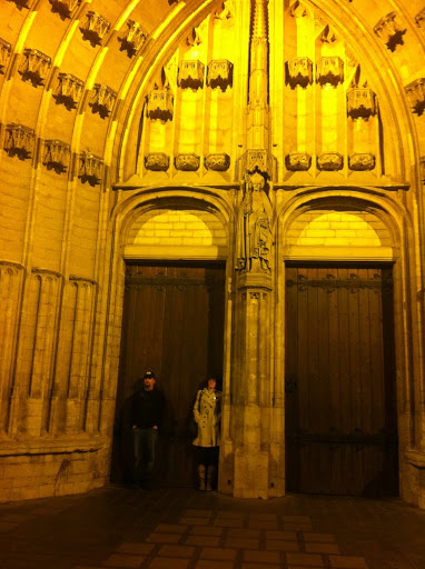 |
| Standing under Saint Martin doorknob |
 |
| Gaufres with Goofs |
And then began the War Tour. Not far from Kortrijk are the battlefields of World War 1. Being Canadian (and Australian!), we visited Passchendaele (now known as Passendale).
Brief (and probably erroneous) Review of Battle of Passchendaele: Attempt at a British breakthrough through the trenches of a German held Western Front. The Canadian Corps took Passchendaele Ridge on 6th of November 1917, ending the first 3 month long battle. 8 kilometres of wet and muddy territory exchanged at the [disputed] cost of approximately 600,000 soldiers. In the eminent sensibility of army generals, the Ridge was continually fought over, passing back and forth until October 1918.
Now, Passendale is a town with 1950s houses, annoying suburban roads, and a Canadian Passchendaele Memorial on the former site of Crest Farm. It is a simple granite block, sitting on a raised grass park at the end of Canadalaan. Standing there, I found it hard to imagine the rolling green fields as a battle-ground. The countryside is still and lush, far removed from its previous incarnation of brutal war. Reminders of war are everywhere. Driving down a nearby road was a memorial to a Nova Scotia battalion. Every village cemetery has statues of soldiers, and names of local lost boys.
 |
| Passchendaele Canadian Memorial |
 |
| Lettenberg British Bunker |
Next on the theme tour was a series of bunkers in Lettenberg hill. Built in 1917 by the UK 175th Tunneling Company, the bunkers were used briefly as HQ and as an infirmary. Inside the bunkers, the connecting tunnels have been caved in or boarded off. Climbing up the hill, holes into the roof system can be seen. Out of the wooded copse, there are more green rolling fields of Flanders with a view down to the town of Kemmel. Going back to the car, we went the long way. Some walked serenely down the slick grassy hill. Another ran down at full steam to the roadway.
 |
| Hill down to Kemmel |
We purchased tickets for the next site at the Kemmel info booth, from a very nice (and probably very bored) young pregnant lady. She gave us custom directions on a map to find the Bayernwald trenches - which the driver and the navigator both messed up. That's ok. There is always one person in the car who knows where she is, and we re-directed ourselves back on course. Without the aid of the annoying iPhone lady. Parking was safer than anticipated (the warning of deep mud at the side of the road was heeded but not needed) and a quick 200 metre walk (punctuated with "are we there yet" and "are you sure this is the right way") brought us to a locked enclosure.
 |
| Overgrown Trench |
 |
| Bayernwald German Trenches |
The Bayernwald trenches were inhabited by German troops until June 15th, 1917 - after the Battle of Messines Ridge. In 1916 the Australian, Canadian, New Zealand and British engineers began tunnelling towards and underneath the German trench system. Mines were laid, in tunnels totalling 8000 metres, 25 meters below the surface. The countermining effort used stethoscopes to listen for digging, as well as exploratory tunnels. If belligerents met underground, they would duke it out man-style fisticuffs.
Over a period of 17 days, the British bombarded the German trenches. This ended at 2:50 am, June 7th. The silence did not last long, as 20 minutes later the mines went BOOM. Of the 22 mines laid by the Brits et al., 19 were detonated. 1 had been found by the Germans and 2 were too far away (after WW1, these were in an unknown location due to British Intelligence not being intelligent).The largest crater formed was 80 metres wide and 12 metres deep. General Plumer had prophesied the night before that "we shall certainly change the geography". Yup. they did. They also killed 10,000 German troops, and utterly destroyed German defence morale. After the bombardment and mines, British troops waltzed behind a "creeping artillery barrage" of tanks and gas canisters. The battle was won by the Brits, and despite attempts by the Germans, held in British hands. This battle also set up a massive mishandling of Passchendaele.
Of the two missing mines, one exploded in a thunderstorm in 1955, killing a cow. The other's location is currently "believed to have been pinpointed" but is unrecovered. I'm sure the locals are really #&%*$)# happy with that.
Even in Bayernwald, with the clouded sky and drizzling atmosphere, I still find it hard to imagine a soldier's life. The trenches were once tensely quiet to avoid targeting, and then shatteringly loud during bombardment or arms firing. There were probably days of exhausting, hunched boredom, followed by adrenaline inducing fear. The ever present realities of filth, damp, rot, smell, noise, starvation, illness of trench warfare can't be felt today. Imagination helps, but isn't enough.
Back in the car we piled. Our day wasn't over yet, but the journey through Belgium was. At some point, we passed into France and the oncoming darkness.
Photo of the Moment:
Next Installment: France.
Photo of the Moment:
 |
| Matt inspecting a bunker |
Next Installment: France.
i think that it's awesome that you took the time to pay your respects at all the different war monuments, we lead a cushy life, it's easy to forget that it wasn't always that way.
ReplyDelete