Friday, February 25, 2011

Road Trip: Part Three A: France

After we leave Belgium, we head into France. Out of the dark rises the Vimy Memorial. We see tons of stuff in Normandy and eat food. We (the boys) drive a lot. This post contains a brief video from the BBC. Caution: contains educational information.


By the time we hit the French-Belgian border, the fog had landed and the darkness had gotten darker. As it tends to do in the evening. Toodling along, we sped past towns and whipped by round-a-bouts. Following a combination of manual maps, iPhone navigation and road signs, the town of Vimy approached us (depending on one's frame of reference).

At some point, some one glimpsed a white bobble on top of a hill, off in the mist. The shapeless bobble slowly turned into two imposing white towers. The Vimy Memorial sits as a sentinel on a 250 acre ridge-top battle field. The darkness stopped us from exploring too far around; partly because the fading light was going to make pictures difficult, partly because the fading light made seeing the "do not walk" signs difficult to see. And trust me, with the vast number of buried World War 1 ordinance and tales of exploding sheep, vaguely wandering around was not an option. This was the location of the Battle of Vimy Ridge. 
Canadian National Vimy Memorial
The Canadian National Vimy Memorial is massive.  In the 1920s, a design competition was held and won by a Toronto lad named Walter Seymour Allward. It took 11 years to build out of cast concrete and bonded limestone and was unveiled in 1936. The memorial was restored starting in 2005. The memorial is not dedicated to only those of Vimy, but to all soldiers that took part in coming-of-age of Canada on the world stage. Vimy is said (repeatedly by other Matt) to be moment in history that Canada became its own nation, and not just part of a realm of the Queen. I will let the pictures speak for the site.

Having been done with the site as far as we could, and leaving other parts of the park to explore for the next visit, we headed back down the hill to the Café d'Érable (Maple Cafe!). Eating our overpriced pre-dinner sandwiches (plus coffee and cola light) surrounded by artfully hammered brass shells. 

Now for driving. I had really wanted to stop in Honfleur, to show off a gorgeous French sea-side town. Instead, we blasted by on the highway, trying to get as close to the next destination as possible. We passed over the beautiful Le Havre bridge, and then got off the highway onto a smaller set of roads. Suddenly, there was a bright flash and a bunch of swearing. It was an unmarked speed camera. Oh well. 

Lisieux
On to Lisieux and a hotel. A hotel in which I kept having déjà vu moments. According to faulty memory, I have been in the hotel for a pre-booking critique and rejection during a bike trip with my father and sisters. We had been on a tour of the Brittany and Normandy region over two weeks. With this trip, I would be looking at many of the same sites, in a 3 day stretch. Certainly different ways to travel. However, after staying in that hotel for a night, I understand why it was rejected the first time. Dingy!

Breakfast the next day (Day 5) was excellent. In a neighbouring patisserie, there were croissants, pain au chocolate, pain au raisin, brioche for eating and cafe and cola light for drinking. I picked up some local jam (vanilla apple and blackcurrant). We cracked a few lame jokes about the lop-sided cathedral and packed ourselves into the car.

Calvados Distillation

The first stop of the day was at about 11 A.M. and alcoholic. Outside a small village, at a calvados distillery we had a tour and a tasting. Calvados is an apple based spirit. Products at this particular distillery include a fizzy cider, a creme liqueur and a wide age range of calvados. You can also trinket up with everything from napkins to key-rings. Tipsy (not really)  and loaded up with even more booze than before, our poor heavy car got moving.


Laplace Backside

Stop #2 was a pure accident. It may have been a bathroom-break, or perhaps just curiosity, but we stopped in another small village. By pure accident, we had stumbled upon the birthplace of Pierre-Simon Laplace: an all-around smart guy whose mathematical machinations torture students and excite nerds world wide. Laplace applied new mathematical techniques to everything: "celestial mechanics", surface tension, probability, mathematics, et cetera.  Now, he has an asteroid named after him, his name is engraved in the Eiffel tower, and there's a bronze replica of him in the town square of Beaumont-en-Auge. Beaumont-en-Auge had fantastic old buildings and stunning views as well. (My) Matt was the sole member to walk up to the church and reported a restoration of a falling down facade, and a public WC around the corner.

Seaside Villa
Stop the third occurred after a sojourn along coastal towns. The destination was Juno Beach, in Courseulles-sur-Mer. The Juno Beach Centre was set back from the dunes of the beach, and houses a museum. A series of interactive exhibitions tell the story of war from a Canadian perspective. There is information about life before the war, the efforts of civilians and soldiers, and the aftermath of international and regional relations. Juno Beach itself is sandy and beach like. There are a few tanks and concrete bunkers in the area, but the majority of the space is sand and sea. In an environment that is undergoing perpetual swift change, it is not the same as when the D-Day soldiers stormed landward. 

Juno Beach Bunker
Fourth stop was Bayeux. In Bayeux is 224 feet (63.4 metres) long embroidered cloth. It is akin to a multi-panel comic strip, telling the story of the French Norman conquest of Anglo-Saxon England by William the Bastard Conqueror. The story starts with the death of King Edward who sends Duke Harold to Normandy. Harry is supposed to tell William the Bastard that upon the death of Ned, Bill is to become King of England. However, Harry is a twit, gets lost and is captured by Guy in Normandy. Guy and Bill exchange prisoners, and Harry goes for a bit of a battle with Bill near Mont Saint Michel. After the battle, Bill knights Harry and they have a party. Harry goes back to England and a dying Ned, and becomes King against ned's wishes. Bill gets annoyed and decides that he is going to invade England for his rightful crown. Bill lands with his knights and horses, and the Normans and English proceed into battle. This is the historical Battle of Hastings. Here, Harry dies with an arrow in the eye. 


It is exceptionally detailed, and comes with latin inscriptions about the scene as well as appropriate decorations on the borders. The tapestry was probably commissioned by Bishop Odo (William's half-brother). It must date from soon after the 1066 invasion, which makes it over 900 years old. The type of embroidery used, as well as the dyes and even the text lead towards England being the place of manufacture. It is also thought that the tapestry is missing crucial ending scenes of William's coronation. One thing to remember about the tapestry is its origin. It depicts the views of the conquering Normans. As with many historical document, it does not tell the story of the losing side. 
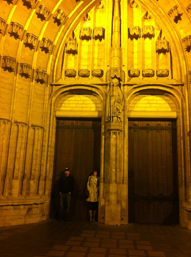
Bayeux Cathedral
The tapestry's original home was the Bayeux Cathedral - completed in 1077 and commission by Odo. Since we were in Bayeux, we went to it. While the place itself is massive and gorgeous, it is hard to distance the disturbing practices of its creation. Built over Roman ruins, it is an ornate gothic building housing the usual complicated stained glass window, a crypt under the transept/nave crossing, an organ and outer reconstruction. The detail is magnificent, and must have taken thousands of man-hours to complete. And only a few moments to photograph.


Hotel Room
We headed out of Bayeux, and further westward. We arrived in Pontorson in time to be picky about hotels, and actually ended up in another Best Western. The Hotel de Montgomery was awesome! At least more awesome than the night before. It seemed like two houses shoved tighter, and the floor plan was ridiculous! Rooms were in no particular location, and no particular order. There were random steps on a floor, and cupboards and mirrors that imitated doors and corridors. Styles ranged from modern to grandma. Matt and I got the floral room; Vicki and Matt got the orange room. At some point during the night, I was bitten by a devilish little bug, leaving me with itchybites on my face and shoulders. No one believed me, but it happened there and I still have them (at the time of writing)!

Vicki, (my) Matt and myself went out for dinner. I had checked review for restaurants briefly, but there wasn't much choice regardless. The dish of the region is agneau pre-salé: lamb that has been feeding on the highly salted tidal grasslands at the foot of Mont Saint-Michel. When the lamb could be found amongst the fat, it was delicious. None of us actually ordered a proper meal, only the meat course, and so tummies were left rumbling. Food still had to be found for (other) Matt, as he was all tied up in the hotel room with an internet connection. He got shwarma sandwich. And probably a cola light. Oh, sandwiches!


Photo of the Moment:


3 Twits in a Barrel


Next: Continuation of France

Wednesday, February 23, 2011

Road Trip: Part Two: Belgium


We travel through Belgium, spending most of our time looking at World War One points of interest. Passchendaele Ridge, Lettenberg Bunkers, Bayernwald Trenches. Writing gets a bit history-lesson, look at the pictures if you're bored. 

Antwerp Sunset
The car got going, and we headed into Antwerp. It took us under an hour of car travelling. Awesome! Finding a Belgian bistrot, lunch was devoured along with 2 Coca Cola Lights and a Trappist Beer. Eating took until 4:15 pm, at which time Matt and I went to look for a ING bank. Oddly, the local ones had closed at 4:00pm on the dot, and we were something-out-of-luck. Having left Matt and Vicki to look in the local shops, we headed back to our arranged meeting point the long way around (y'know, past the information point, near the church, through some back streets and then past a bit of getting lost and found again).  The light had already started to fade by our appointment time. 

Standing under Saint Martin doorknob
In the dark, we made it to a town called Kortrijk, near the French-Belgium border. Stayed in a chain Ibis hotel, which is neither exciting nor horrid. The restaurants that were open were near the central square. In the square was a belfry of the Flanders region. These 56 UNESCO World Heritage belfries in France and Belgium were built during a time of emerging Flemish independence against feudal and religious oppression. The Kortrijk belfry was once attached to a much larger building, but now stands alone. We were lucky enough to be standing below it as the (probably automated) bells began to peal at 11pm. On the way back from a delicious dinner, we went past the Saint Martin Church, and were ridiculous in the neighbouring playground. 20-somethings and spring loaded see-saw animals are not supposed to mix. 

Gaufres with Goofs
The morning after (Day 4) in Kortrijk was a time to sort out some new footwear, and some electronic items. It meant fewer foot-blisters, more travelling tunes and less beard bristles. There were also Belgian waffles! Bet you were wondering about those…. yummy! 

And then began the War Tour. Not far from Kortrijk are the battlefields of World War 1. Being Canadian (and Australian!), we visited Passchendaele (now known as Passendale). 

Brief (and probably erroneous) Review of Battle of Passchendaele: Attempt at a British breakthrough through the  trenches of a German held Western Front. The Canadian Corps took Passchendaele Ridge on 6th of November 1917, ending the first 3 month long battle. 8 kilometres of wet and muddy territory exchanged at the [disputed] cost of approximately 600,000 soldiers. In the eminent sensibility of army generals, the Ridge was continually fought over, passing back and forth until October 1918.

Passchendaele Canadian Memorial
Now, Passendale is a town with 1950s houses, annoying suburban roads, and a Canadian Passchendaele Memorial on the former site of Crest Farm. It is a simple granite block, sitting on a raised grass park at the end of Canadalaan. Standing there, I found it hard to imagine the rolling green fields as a battle-ground. The countryside is still and lush, far removed from its previous incarnation of brutal war. Reminders of war are everywhere. Driving down a nearby road was a memorial to a Nova Scotia battalion. Every village cemetery has statues of soldiers, and names of local lost boys. 

Lettenberg British Bunker


Next on the theme tour was a series of bunkers in Lettenberg hill. Built in 1917 by the UK 175th Tunneling Company, the bunkers were used briefly as HQ and as an infirmary. Inside the bunkers, the connecting tunnels have been caved in or boarded off. Climbing up the hill, holes into the roof system can be seen. Out of the wooded copse, there are more green rolling fields of Flanders with a view down to the town of Kemmel. Going back to the car, we went the long way. Some walked serenely down the slick grassy hill. Another ran down at full steam to the roadway.

Hill down to Kemmel
Tummies rumbling after exhausting exercise, we headed into Kemmel's village square to find lunch. Finding food was a bit of a problem, as the only open place was a smoke-filled motorcycle bar. Outside the window, a group of six cyclists were seen circling the square, smoothly cruising over cobbles. They came in after for their own R&R, dressed to the nines in matching kit over the pot bellies and grey fuzz. I tried explaining that cycling is a normal activity in Belgium, and that cobbles are a part of a long tradition, culminating in an intense race from Paris to Roubaix (which we were fairly close to, geographically). We asked for directions to the tourist information site, and left to get some fresh air and car sandwiches of stinky cheese and salami. 
   
We purchased tickets for the next site at the Kemmel info booth, from a very nice (and probably very bored) young pregnant lady. She gave us custom directions on a map to find the Bayernwald trenches - which the driver and the navigator both messed up. That's ok. There is always one person in the car who knows where she is, and we re-directed ourselves back on course. Without the aid of the annoying iPhone lady. Parking was safer than anticipated (the warning of deep mud at the side of the road was heeded but not needed) and a quick 200 metre walk (punctuated with "are we there yet" and "are you sure this is the right way") brought us to a locked enclosure.

Overgrown Trench
The Bayernwald trenches date from the end of 1914, and were dug by German troops. The original trenches had long been covered over by the passing of time, but now the network has been dutifully excavated and recreated from war maps and records. The trenches have a simple drainage system, duckboards positioned about 8 inches above the trench floor. The path the trenches take are serpentine, curving so as to prevent mass damage from bombs and gunfire. The bunkers - original to World War 1, are dark and flooded. The walls are held up with interwoven sticks, and concrete filled jute sacks outline the trenches. At one spot there is a mineshaft - dug by the Germans to counteract and listen to the British mining activities. Some of the trenches continue out of the enclosure into surrounding fields. Those are much shallower and narrower as erosion fills them back up with soil and plant life. 

Bayernwald German Trenches
The Bayernwald trenches were inhabited by German troops until June 15th, 1917 - after the Battle of Messines Ridge. In 1916 the Australian, Canadian, New Zealand and British engineers began tunnelling towards and underneath the German trench system. Mines were laid, in tunnels totalling 8000 metres, 25 meters below the surface. The countermining effort used stethoscopes to listen for digging, as well as exploratory tunnels. If belligerents met underground, they would duke it out man-style fisticuffs. 

Over a period of 17 days, the British bombarded the German trenches. This ended at 2:50 am, June 7th. The silence did not last long, as 20 minutes later the mines went BOOM. Of the 22 mines laid by the Brits et al., 19 were detonated. 1 had been found by the Germans and 2 were too far away (after WW1, these were in an unknown location due to British Intelligence not being intelligent).The largest crater formed was 80 metres wide and 12 metres deep. General Plumer had prophesied the night before that "we shall certainly change the geography". Yup. they did. They also killed 10,000 German troops, and utterly destroyed German defence morale. After the bombardment and mines, British troops waltzed behind a "creeping artillery barrage" of tanks and gas canisters. The battle was won by the Brits, and despite attempts by the Germans, held in British hands. This battle also set up a massive mishandling of Passchendaele.  

Of the two missing mines, one exploded in a thunderstorm in 1955, killing a cow. The other's location is currently "believed to have been pinpointed" but is unrecovered. I'm sure the locals are really #&%*$)# happy with that. 

Even in Bayernwald, with the clouded sky and drizzling atmosphere, I still find it hard to imagine a soldier's life. The trenches were once tensely quiet to avoid targeting, and then shatteringly loud during bombardment or arms firing. There were probably days of exhausting, hunched boredom, followed by adrenaline inducing fear. The ever present realities of filth, damp, rot, smell, noise, starvation, illness of trench warfare can't be felt today. Imagination helps, but isn't enough. 

Back in the car we piled. Our day wasn't over yet, but the journey through Belgium was. At some point, we passed into France and the oncoming darkness.

Photo of the Moment:


Matt inspecting a bunker


Next Installment: France.

Monday, February 21, 2011

Road Trip: Part One: Netherlands.


(My) Matt and I (Liz) welcome (other) Matt and Vicki to Europe by a whirlwind 2 week trip through the Low Countries, the Alps, and the Black Forest. Pre-planned to an extent, this is what really happened.  Below follows Days 0 to Day 3 through the Dutch Countryside. 

(Other) Matt and Vicki arrived early Saturday morning (Day 0), jetlagged and probably cramped from the plane ride. That day, they experienced the wonders of the inside of our house - either sleeping' or teeveein'. 

The next day (Day 1), Sunday, was a wander day. The main attraction of the day was the Anne Frank Museum. The Secret Annexe is a small section of a canal house on Prinsengracht. Prinsengracht is one of the wider ring canals of Amsterdam, and the house is located between the tight and twisty streets of Nieuwekerk and the tree-lined avenues of Jordaan. I had prebooked the Anne Frank tix, as overtime we'd walked by the line was around the block. This means that we just sailed on into the museum. 

Matt1 and Matt2: in Motion. 
The first part of the Anne Frank Museum is an introduction to the history of the  buildings themselves. One enters through 265, and the office building is 263. The entrance to the Secret Annexe is up a steep flight of narrow stairs. Still, there is the bookcase that hid the door. It forces one to stoop as well as step up simultaneously. The rooms are bare, except for Anne's, which has the original wallpaper with a multitude of photos stuck to it. The emptiness is because the SS cleared out furnishings after raids. Otto Frank decided to keep the rooms unfurnished. 

I can't really explain visiting the Annexe. It is a place that one should visit, and a place to remember in both Anne's writing and in person.

Monday (Day 2), we headed out to Amsterdam's Schiphol Airport to pick up our car. We had no choice but to concede to Avis' availability. Not a diesel Volkswagen Golf as ordered, but a gas Kia C'eed. However, the car  drives forward and backward without problem, and is currently carrying the luggage of 4 people and the large assortment of purchased souvenirs. It was the beginning of our massive two-week road trip. 

Of course, we started the trip going in the wrong direction, and following the idiotic directions of the iPhone navigation application. It was especially bad in the downtown of Rotterdam. It was really only supposed to be a quick pit stop, but it was near impossible to leave the core. We had to go over the Willemsbrug twice, and do about 3 U-turns to get onto the correct street. Either Rotterdam has awful city-planning, or the nasally British iPhone lady is a dumb-dumb. 

Historical Windmills and the weteringen
After driving for about an hour by route signs, we started to follow the iPhone's directions to our first Dutch stop: the Kinderdijk. Built around 1740, there are 19 wooden windmills along countryside canals (weteringen) outside of Rotterdam and at the confluence of two rivers. The windmills were used to pump the water out of the polder (low-lying land, protected by dikes), to keep the fields dry enough to plow.   Some were in perfect condition, others were being restored. It seemed that some were homes for families. Imagine living in a windmill! All the rooms are round, and the staircases up the four floors are steep and narrow. Also, one would be living with a whole bunch of giant wooden gears. Neat though. 

After the Kinderdijk, we headed to the coast of the Netherlands. The coast is where the Delta Works project holds back the ocean forces from the low-lands. It started after the 1953 floods that devastated Zeeland. The initial concept was to create a fresh water inland sea in one region, while leaving the ports of Rotterdam and Antwerp open to the sea. Public pressure in the form of environmentalism and capitalism adjusted the plans. Now, there are moveable barriers, earth dikes, and kilometres long bridges. The combinations allow for economic growth in the region, and the conservation of a unique enviroment.


Modern Windmills and the North Sea.
Driving south, the right is the North Sea, to the left is the estuary of the Rhone, the Meuse and the Scheldt rivers. These rivers cut through Europe, starting in either northern France or Switzerland. At first glance, it is hard to distinguish between the sea and the river. Both sides have some built-up villages, and the associated sailboats in any summer town. There are large fishing boats on either side of bridges. This combination of bridge-boat delayed our journey for about 15 minutes. But we got to see a trawler head from under a drawbridge and out into the ocean at sunset. By the time we exited the estuary it was dark. Underneath the last finger of the river delta is an lengthy (6.6 km) car tunnel. So after going over and beside the ocean, we went below to Hulst.

Hulst is a small fortified Dutch town in Zeelandic Flanders, a part of the Netherlands that has no land connection to the rest of the country. In Hulst are a windmill, church and belfry - three buildings defining a typical Dutch town. Hulst was the last major siege during the 80 Years' War, when the Dutch conquered the city from the Spanish in 1645. It is an important control point for the left bank of the Schelde river. The walls are star shaped, and built in the 17th century after an Italian design.


Our hotel was outside of the walls, and faced the main archway gate. From the window could also be seen the moat, a cannon and small cobbled streets. It was a glittering and gorgeous view at night, and another reason I want a camera tripod.

Walking along the walls the next morning (Day 3) was beautiful. The walls were not lost in masses of suburbia; they rose above the moat and parkland on the outside of Hulst. From the pathway on the walls we explored a decrepit fortified tower, the enormous windmill and eventually the town streets. Houses were a mix of old and new Dutch townhouses. Ready to Move. Back to the Car. Time to get Gas.

Or not.  We had an idiot-event involving a gas burning car, a diesel pump, bad instructions and bad execution and bad observation. 3 hours of waiting around to sort out the issue. Each of us figured out something to do. I think that the trunk was rearranged, photographs were taken, conversations were had, as well as pine cone/stick T-ball, juggling, eating sweets, getting groceries, pushing the car into a parking spot and generally annoying the poor woman who worked at the gas station. Everything was fixed by a local mechanic. Petrol was then put into the car, followed by the people. Off to a new country and a new city.


Photo of the Moment: 


C-c-c-click Candidly.


Next installment: Belgium. 

Saturday, February 5, 2011

Amschterdam

Matt and I have been in Amsterdam for the past two weeks, basically sitting on our patooties. On some of the gorgeous days, we headed around town for walks and sightseeing. Hence the quiet time on our end. On the days that have been rainy, windy, cloudy and cold we've been inside trying to plan the remainder of our time here.

Part of that is the arrival of our friends Matt and Vicki. Oh yes, the fun of two Matts in one place. Especially these two Matts. The four of us are going to travel from Amsterdam to northern France, Switzerland and Germany. Hopefully. The plans are quite flexible, and the story will unfold as we go.